The spatial resolution of infrared (IR) polar imagery (e.g., Suomi NPP VIIRS and MODIS) is currently superior to similar geostationary data over North America (~1km vs 4km). Unfortunately, there are relatively few polar passes a day over the contiguous United States. At best, there would be 2 passes over any one location every 12 hours for each polar satellite. This is one reason why it is challenging to introduce operational forecasters to the advantages in using this imagery.
This will all change over the next year with the National Weather Service’s (NWS) second generation Advanced Weather Interactive Processing System (AWIPS2), and the use of polar imagery will become more and more common within NWS Forecast Offices. This is because AWIPS2 will allow the forecaster to overlay multiple images to create GOES/POES hybrid satellite loops.
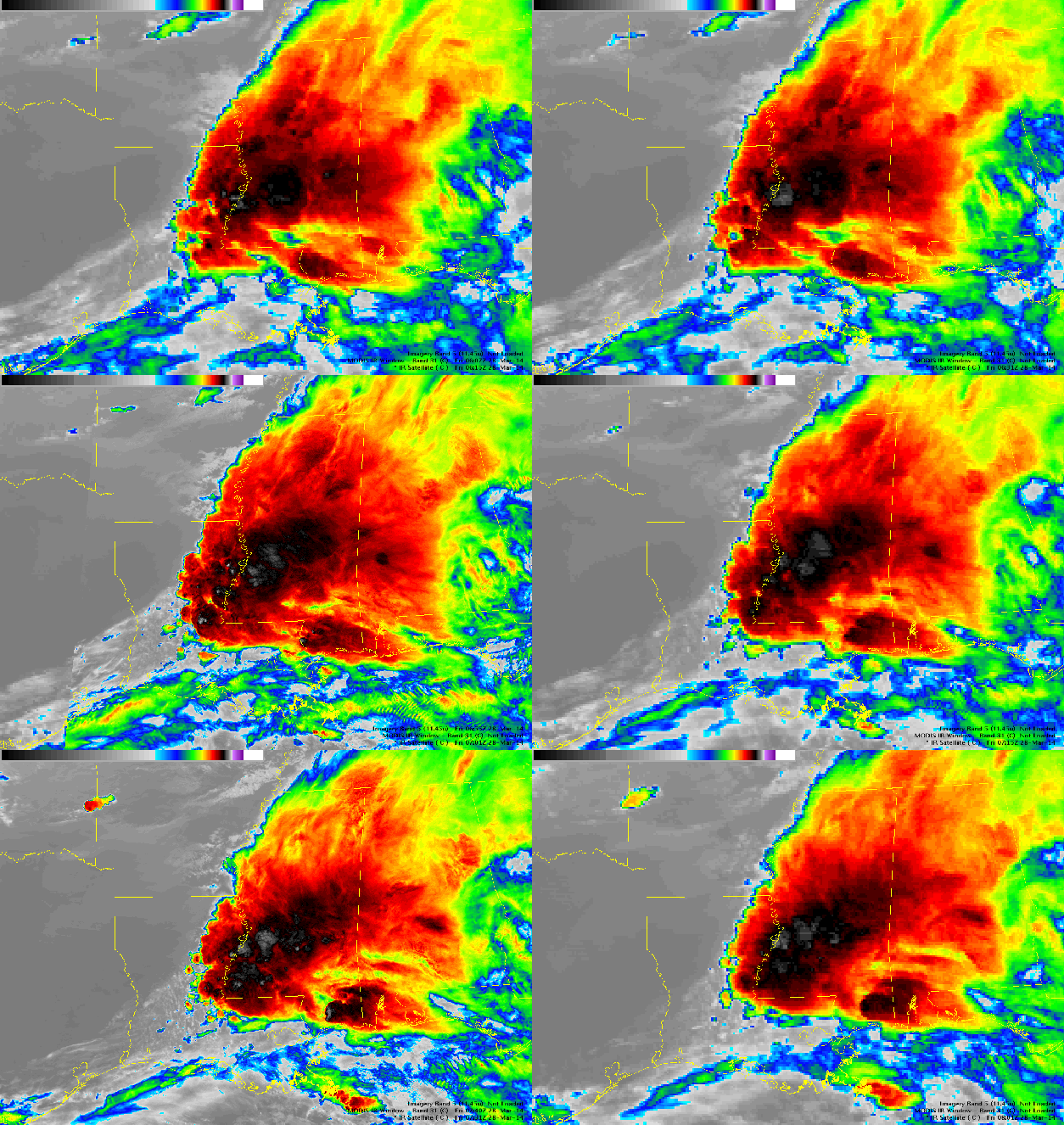
In the image below, this capability is shown using IR imagery from GOES-13 (10.7 μm), MODIS (~11.0 μm), and Suomi NPP VIIRS (11.45 μm) between 0615 and 0801 UTC on 28 March 2014 over the Southern Mississippi Valley.

IR imagery from GOES-13 (10.7 μm), MODIS (~11.0 μm), and Suomi NPP VIIRS (11.45 μm) between 0615 and 0801 UTC on 28 March 2014 (click image to enlarge).
When polar imagery is available from MODIS or VIIRS, it is overlaid on the GOES imagery which allows the forecaster to take advantage of the greater spatial resolution of the polar imagery. In the example shown above, there are GOES-13 images at 0615, 0631, and 0645 UTC, followed by a VIIRS image at 0655 UTC, two more GOES-13 images at 0715 and 0731 UTC, a MODIS image at 0740 UTC, and one more GOES-13 image at 0801 UTC. As the forecaster cycles through the images, you can envision how this capability would be beneficial. The increased spatial resolution from MODIS and VIIRS allows important details to be extracted which include the location and strength of updrafts/overshooting tops and the location where new convection is forming on the southwestern flank of the MCS. In addition, when deep convection is present, the parallax (GOES pixels are displaced slightly poleward from their correct position) that occurs with geostationary satellites is magnified and the polar imagery “corrects” the location for the forecaster. To see the full impact of these hybrid images, click on the image for a full resolution version.
AWIPS2 is currently being installed at NWS forecast offices throughout the country. +